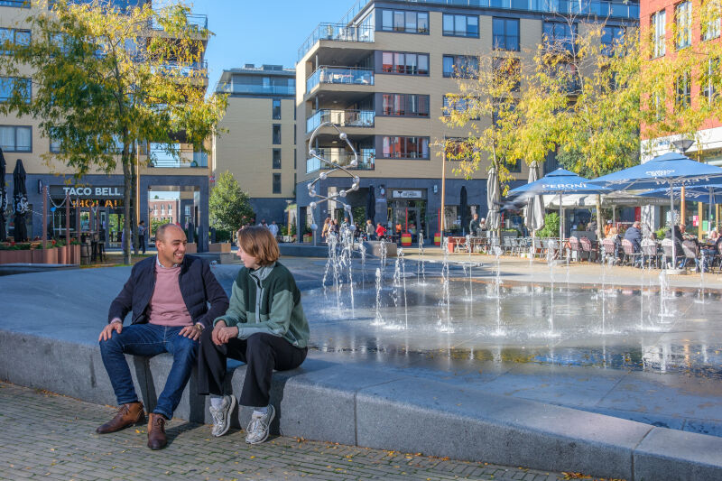
Cover: Campus Wevelgem, an example of the redesign of a campus with many facilities, taking into account slow traffic. Intercommunale Leiedal ©
In the evolving landscape of urban development, the "10-minute city" concept has emerged as an approach to creating more liveable, sustainable, and inclusive urban environments. Building upon the global "15-minute city" framework, popularized by Carlos Moreno and first widely implemented in Paris, this idea envisions neighbourhoods where residents can access essential services such as education, healthcare, retail, and recreational spaces within a 10-minute awalk or bike ride from their homes.
Brusselplein, Leidsche Rijn, Utrecht. Leidsche Rijn is one of the key urban hubs in Utrecht’s 10-minute city approach. Photo: Jelle Verhoeks
While T4R partners City of Brussels, Leiedal region (Belgium), Utrecht and Amsterdam (The Netherlands) are not the originators of the concept, they are recognized as European frontrunners in applying and adapting its principles to their local contexts. Cities like Paris, Melbourne, and Portland have pioneered proximity-based urban planning since the mid-2010s, but the City of Brussels and Utrecht and the region of Leiedal are among the first in Belgium and the Netherlands to embed the 10-minute city into comprehensive urban strategies.
Since 2018, Brussels has pursued this vision through its Municipal Sustainable Development Plan, BXL 2050 and targeted planning tools, including a recently launched interactive map that visualizes access to everyday services. Utrecht has fully integrated the 10-minute city model into its 2040 Spatial Strategy, focusing on the development of decentralized urban hubs to support local living. Leiedal applied the concept flexibly across the 13 cities and municipalities of South West Flanders, allowing each to set accessibility thresholds (x-minutes) based on their specific local context and detect the needs and wants of a neighbourhood.
In this article, we explore how three T4R partners - the City of Brussels, the City of Utrecht, and the Leiedal region - are applying the 10-minute city concept locally.
City of Brussels
How does the City of Brussels define and interpret the 10-minute city concept?
The City of Brussels is currently facing a number of urban challenges, including demographic growth (which implies an increase in demand for affordable housing and access to urban facilities) and the need to develop its resilience in response to climatic hazards (increased flooding, heatwaves, drought, etc.). Regional development and densification must therefore be anticipated and controlled by the public authorities through urban planning based on polycentrism and the concept of the local city model.
For the City of Brussels the ‘10-Minute City’ is both a territorial development principle and an online cartographic information tool. The goal is to ensure that all citizens - residents and visitors alike - can access the facilities and services essential to urban life within a 10-minute walk from any point in the city.
Were residents involved planning and implementation?
Yes. Citizen panels were engaged via the BXL 2050 process, including surveys and data collection conducted by the Brussels Studies Institute (comprising ULB, USLB, VUB, KU Leuven, and UCL). Public presentations were held before the launch of the platform in September 2024, and a monitoring committee, including regional bodies, was established.
How is success measured?
There are no dedicated KPIs for the 10-minute city yet, the focus has been on launching the platform. However, thematic and sub-thematic scores from the platform act as indicators, showing where new services are needed. Other general indicators are being drafted.
What are the main challenges encountered?
Gathering data and keeping it up to date. The City of Brussels addressed this by improving its governance strategy and by setting up automatic update mechanisms. The Data stewards are your allies.
"The City of Brussels has a key role to play in ensuring equal access to the essential needs of its population in the various neighbourhoods"
How does the framework ensure equity and inclusion?
The general objective of the '10-minute city’ is to improve the quality of life of citizens on a daily basis, with everyone able to benefit from basic facilities and services within 10 minutes of their home, whether by bicycle or on foot. This reduces car dependency, rebalances public space, and supports safer, more inclusive neighbourhoods.
The local offer must adapt to the profiles of residents (age, gender, socio-economic capital, etc.) and to changes in society. In this regards, the City of Brussels has a key role to play in ensuring equal access to the essential needs of its population in the various neighbourhoods. The infrastructures it provides must therefore be resolutely inclusive, taking into account the social plurality of its citizens. Through the theme of ‘living together’ of the 10-minute City platform, the City of Brussels encourages inclusion and a sense of belonging to the community.
A bit more about the 10-Minute City IT Platform
The City of Brussels has developed a geoportal application that integrates and geolocates 72 varieties of facilities and services, divided into four themes: living together, environment & living environment, mobility, and residential economy. They cover 15 sub-themes, including youth, green spaces, health and public transport. Via an interactive tool, which is updated regularly, the tool gives an overview of the range of services and facilities available throughout Brussels and neighbouring municipalities. It takes into account not only the presence of facilities but also their accessibility in terms of walking time. Through a simple click on the map, or via a specific address selection, it shows a score for each of the themes, and most importantly: a list and the location of various services available within a 10-minute walk (or 5-minute bike ride). It also offers a detailed socio-economic and environmental description of the neighbourhood, with the possibility to filter the data according to one’s interest.
Integration with BXL 2050
BXL 2050 is a project for the future of Brussels with a clear vision that is translated spatially. It is not a generic plan for the whole area, but one that takes account of the context and unique characteristics of each neighbourhood in the City of Brussels. The plan is built around 7 clear ambitions covering a wide range of subjects, from fundamental improvements to the environment to strengthening the relationship between the city and its residents. The ‘10-minute city’ concept is anchored in this plan, with the aim of making the facilities essential to urban life accessible to every inhabitant of Brussels in less than 10 minutes. This tool makes it possible to demonstrate where specific needs must be met. It will be used to support strategic decision-making and will also be a valuable tool for citizens.
City of Brussels 10-minute city IT platform:
BXLGIS
More information:
10-Minute city | Smartcity
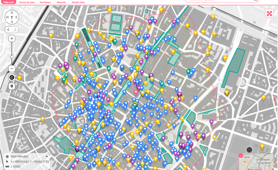
The City of Brussels' 10-minute city IT platform showing services within a 10-minute walk around a specific location.
City of Utrecht
How does Utrecht define and interpret the ‘10-minute city’ concept?
Space in and around Utrecht is limited, while the city faces major growth. This means using available space wisely. Utrecht is creating several new urban hubs around the city, each with many services and connected by strong public transport. Everyday needs should be within about 10 minutes of home or work - by public transport, bike, or on foot - reducing traffic and making active travel easier.
Were residents involved?
Yes. Both the Environmental Strategy Utrecht (RSU2040) and the Urban Planning Vision (detailing spatial quality in the 10-minute city) were shaped with contributions of dialogues with resident. The Urban Planning Vision especially had extensive participation, including city conversations, a digital “Swipocracy” tool, and opportunities for residents, stakeholders, and interest groups to comment on drafts.
What are key challenges?
Time - building a network of centres and transport takes decades. Other challenges include setting priorities, deciding where to start, financing investments, and ensuring each area has its own identity.
What criteria were used for the new urban hubs?
The most important criteria for identifying potential urban hubs are the proximity to exceptional public transport. New developements should not lead to an increase of car traffic in the city. Furthermore, the area should have potential for development, and there should be attention for ownership and spatial planning constraints.
Balancing growth, livability and green infrastrucure
Major growth of the city is concentrated in the new hubs, which have the greatest potential for densification adding housing. At the same time, they can act as 10-minute hubs for surrounding areas. Green and blue corridors are the lifelines of the city, complementing high-density areas. Utrecht is creating a connected network accessible through neighbourhood and street-level greenery.
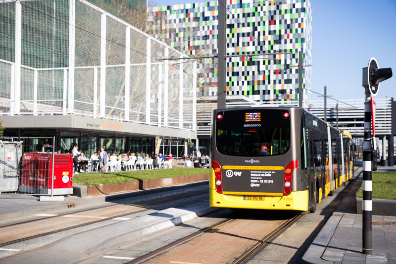
Another city hub in Utrecht is Utrecht Science Park - the area around campuses of the University of Utrecht. Photo: Lois de Vries
Intermunicipal Association Leiedal
How does Leiedal define and apply the 10-minute city?
Leiedal defines the 10-minute city as an approach to spatial planning in which essential services and amenities are accessible within a 10-minute walk or bike ride, promoting sustainable, liveable, and inclusive communities. The concept is applied flexibly across the 13 cities and municipalities in the Leiedal region, allowing each to set accessibility thresholds (x-minutes) based on its specific local context and needs. This concept was developed together with the City of Ghent as part of the project ‘Slim Ruimtelijk Plannen’ (Smart Urban Planning).
What indicators are used to assess the effectiveness of the x-minute city model?
One of the key indicators is the proximity of services to specific target groups. Leiedal maps:
The location of various facilities (e.g. childcare, schools, parks)
The spatial distribution of target populations (e.g. families, elderly, youth)
The walking and cycling network as the primary access infrastructure
To evaluate whether services are sufficiently close, a system of distance thresholds is used in increments of 400 meters, corresponding to approximately 5, 10, and 15 minutes of walking or cycling. This allows municipalities to choose the threshold that best fits their local context.
In addition to proximity, service capacity is also considered: a nearby school or park might be present, but lacking available capacity, which still indicates a shortage. This results in a more accurate picture of local needs per neighbourhood.
Importantly, Leiedal does not limit its analysis to services located within municipal or regional boundaries. Services and amenities located just outside the region can still play a crucial role in meeting the daily needs of residents, especially in border zones or peri-urban areas. Therefore, these external facilities are included in the proximity analysis to ensure a more realistic and comprehensive picture of functional accessibility. An additional challenge is integrating quality of a facility as an indicator. While not yet included in the current model, incorporating quality will be an important next step in refining the data model.
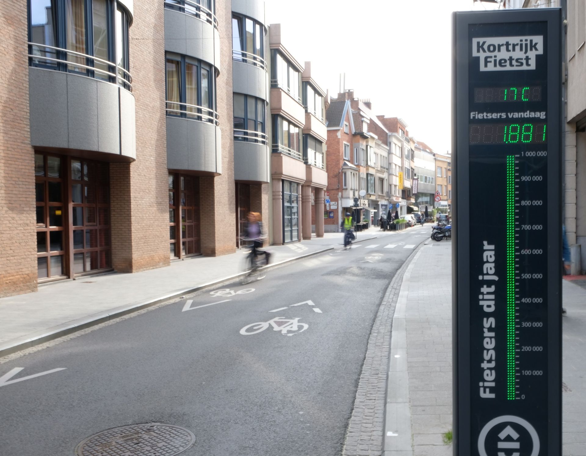
Kortrijk, bicycle counting post Budastreet. Intercommunale Leiedal ©
How does the x-minute city framework ensure equitable access to services across diverse neighbourhoods and populations?
The x-minute city model places emphasis not only on the physical distance to facilities, but also on whether people can access them in practice. This involves assessing how reachable key services are within walking or cycling times of 5, 10, or 15 minutes, allowing municipalities to adopt thresholds that align with their local context and policy goals. At the same time, it is essential to consider the actual capacity of these services. Another important aspect is ensuring that the distribution of services corresponds to where specific target groups live, such as children, elderly residents, or people with limited mobility. Their needs often require greater attention to proximity and access.
What are the main obstacles you encounter with the transition to x-minute cities?
One major obstacle is the fragmentation of urban functions. Not every municipality or neighbourhood has the critical mass needed to sustain certain local facilities in an efficient or viable way. This limits the potential to offer all key facilities within a x-minute walking or cycling radius, particularly in more rural or dispersed areas.
Another significant challenge is the legacy of car-oriented planning. Decades of policy and infrastructure investment have prioritized private vehicle use, making the shift toward active and sustainable mobility more difficult. Changing habits and redesigning public spaces to support walking and cycling requires not only physical transformation, but also cultural change and political support.
A third challenge is the limited availability and usability of spatial data. While open data exists, it's not always standardized or actionable at the municipal scale. Smaller municipalities often lack the tools and expertise to use this data effectively in planning. As a result, evidence-based decision-making remains a challenge, despite its importance for realizing the x-minute city model.
Overall, the transition requires not just spatial and mobility adjustments, but also stronger local governance tools, better data infrastructure, and effective collaboration across government levels.
"Changing habits and redesigning public spaces to support walking and cycling requires not only physical transformation, but also cultural change and political support."
In what way will you use your LDT for the x-minute city transition?
The Leiedal pilot in the T4R project focuses on developing a Local Digital Twin to support better insights and facilitate data-driven decision-making in spatial planning. This pilot explores how an LDT can be used for design research and visualization, monitoring, spatial analysis, and impact assessment.
The x-minute city model supports both need detection, identifying where local facilities are lacking, and scenario testing, such as simulating the effects of new urban interventions. A major advantage is the ability to assess potential facility locations before decisions are made. This enables local governments to make well-informed spatial choices and direct investments to areas where needs are greatest.