Introduction
Leiedal was founded in 1960 on the initiative of the municipalities of the Kortrijk district as an intermunicipal organisation for spatial planning, economic expansion and reconversion. In addition to the development and construction of business parks and social plots, the focus was to invest together in shared expertise to serve the partners. Actually, that story still holds true today. Leiedal puts its expertise at the service of the thirteen cities and towns of South-West Flanders. Since then, Leiedal has grown into a highly versatile service provider. Through intensive interaction with our associates, partner organisations and authorities, we continuously work on the development of this dynamic region, forever aiming to make it an attractive place to do business, work, live and visit.
Responding to societal challenges as to demographics, employment, mobility, housing, energy, ecology and entrepreneurship, Leiedal approaches the increasing complexity of assignments integrally, resulting in broad high-quality support. As a regional developer, Leiedal works closely together with the local councils to their benefit, involving also supralocal authorities, entrepreneurs, knowledge centres, organisations and civilians very intensively in the regional transition.
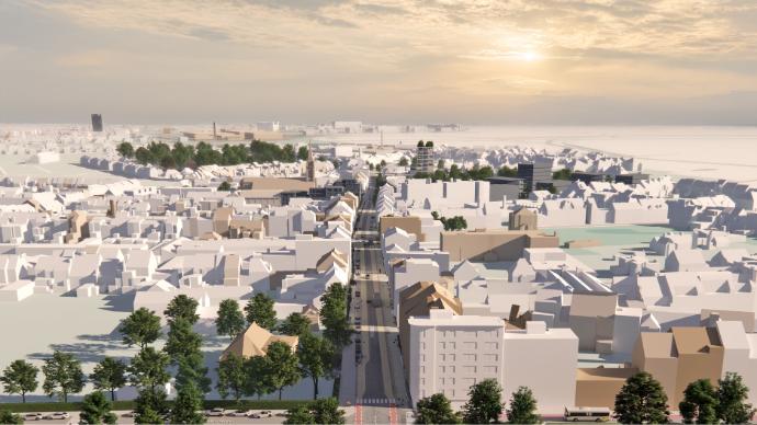
Leiedal's objectives have been translated into six lines of transition for the region in the 2020-2025 Policy Plan. One of the six lines of transition is Digital transformation. This is no longer merely about joint websites. It also entails data, digital tools and fast fibreglass connections. Leiedal collects, updates and processes data and makes them available for several applications. This is called Regional Data Ecosystem, facilitating a data-driven policy in the region and the 13 councils. Through 3D planning, among other things, we are using digital spatial information to develop due design strength and power of imagination. In the near future Leiedal intends to use digital twins as the standard for spatial projects and processes in the 13 affiliated cities and municipalities.
Pilot project
The Leiedal pilot project will focus on developing a digital twin to generate better insights and facilitate data-driven decision-making in spatial planning. Through this pilot case we want to explore how such a platform can serve for design research and visualization, monitoring, analysis, and impact assessment.
Our three-phase approach (exploration, development, evaluation) is currently in the exploration phase. We're collaborating with project partners and stakeholders to identify suitable technologies, spatial data formats, and existing or required 3D assets for the region. Through in-depth interviews with our municipalities we are detecting specific spatial planning use cases. This information will determine the pilot project's objectives and cooperation framework, aiming to tackle spatial, technological, and process-oriented challenges concerning the use case.
The pilot program will be delivered by June 2025. This will mark the start of the development phase.